Fig_1.png
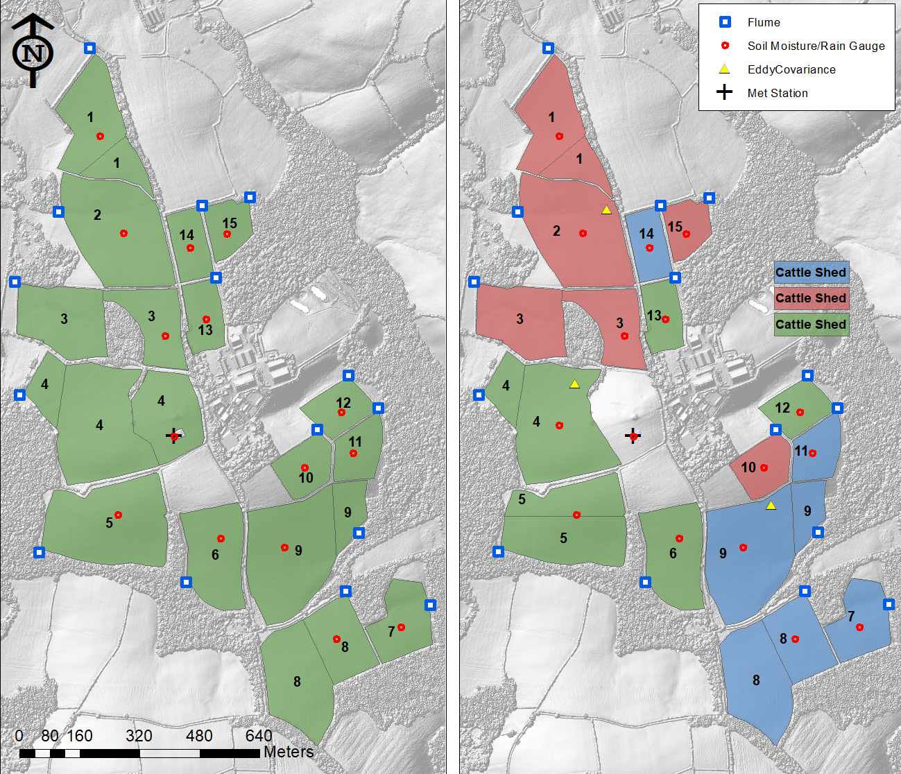
Map of the North Wyke Farm Platform, showing Catchment numbers and flume locations. The left hand map shows the farmlets in the baseline period. The right hand map shows the farmlets post-baseline period, and whether the farmlets were sown with innovative grass species with desirable traits ('reseed'), with a mix of white clover and the same innovative grass species ('legumes'), or whether they continued as permanent pasture
Cite this file as
Retrieved: 20:48 26 Nov 2024 (UTC)
Zusätzliche Informationen
| Feld | Wert |
|---|---|
| Daten wurden zuletzt aktualisiert | 15. November 2024 |
| Metadaten zuletzt aktualisiert | 15. November 2024 |
| Erstellt | 15. November 2024 |
| Format | PNG |
| Lizenz | Creative Commons Attribution Licence (CC BY 4.0) |
| Datastore active | False |
| Has views | True |
| Id | 3ce3d4fb-a5ec-4ee9-a56c-33b3022c1da4 |
| Mimetype | image/png |
| Package id | b3cf55f4-237c-46f1-97ca-2c1d1e876b73 |
| Position | 1 |
| Size | 1,5 MiB |
| State | active |
| Url type | upload |
